Researchers at the Institute for Soil Sciences at the HUN-REN Centre for Agricultural Research (HUN-REN CAR) developed a national 3D soil hydrology database, called HU-SoilHydroGrids, which opens up possibilities for countrywide applications and research studies to analyze environmental problems. They published their work in Science of The Total Environment.
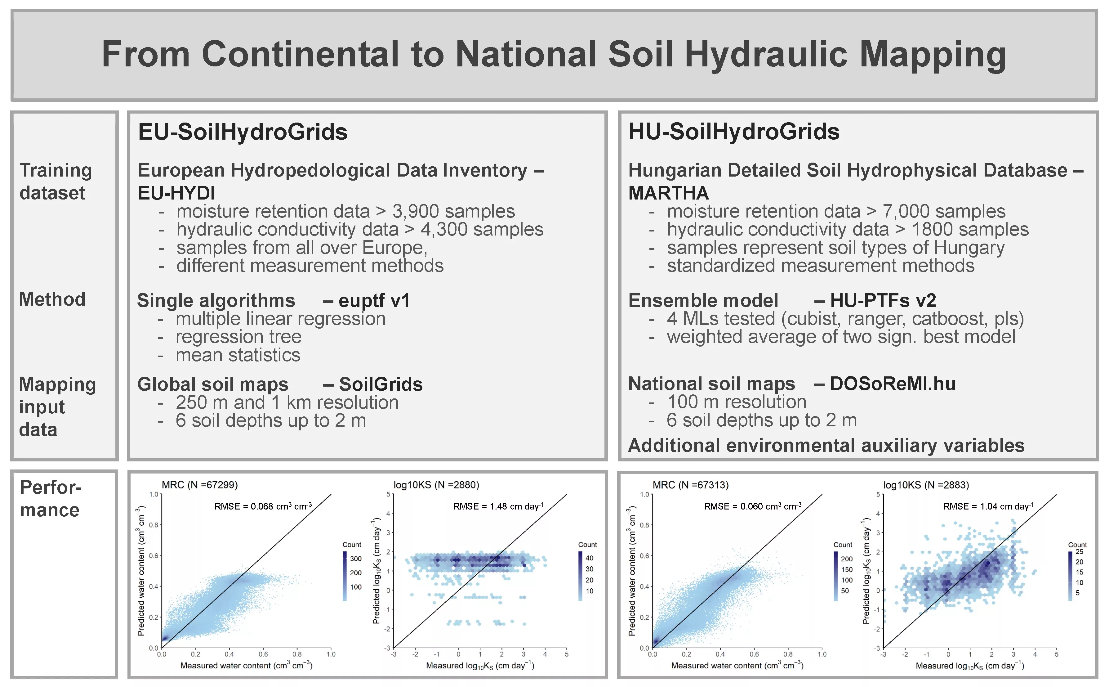
Spatially detailed quantitative data regarding soil hydraulic properties is in high demand for a range of modeling applications. EU-SoilHydroGrids has demonstrated its utility at the European level, contributing to ecological forecasts, geological and hydrological hazard evaluations, and agri-environmental modeling, among other studies. Building on this continental precedent, a comparable but larger-scale, national 3D soil hydraulic database, known as HU-SoilHydroGrids, has been developed for Hungary.
Enhancements in the elaboration process of HU-SoilHydroGrids:
- Pedotransfer functions (PTFs) were developed using advanced machine learning techniques, both independently and as part of ensemble models.
- These models were trained on the Hungarian Detailed Soil Hydrophysical Database, ensuring the derivation of region-specific PTFs.
- The set of predictors utilized in the PTFs was augmented by additional environmental variables with comprehensive spatial coverage, including DEM-derived geomorphometric indices, climatic parameters, OE provided surface reflectance and derived data products, LULC.
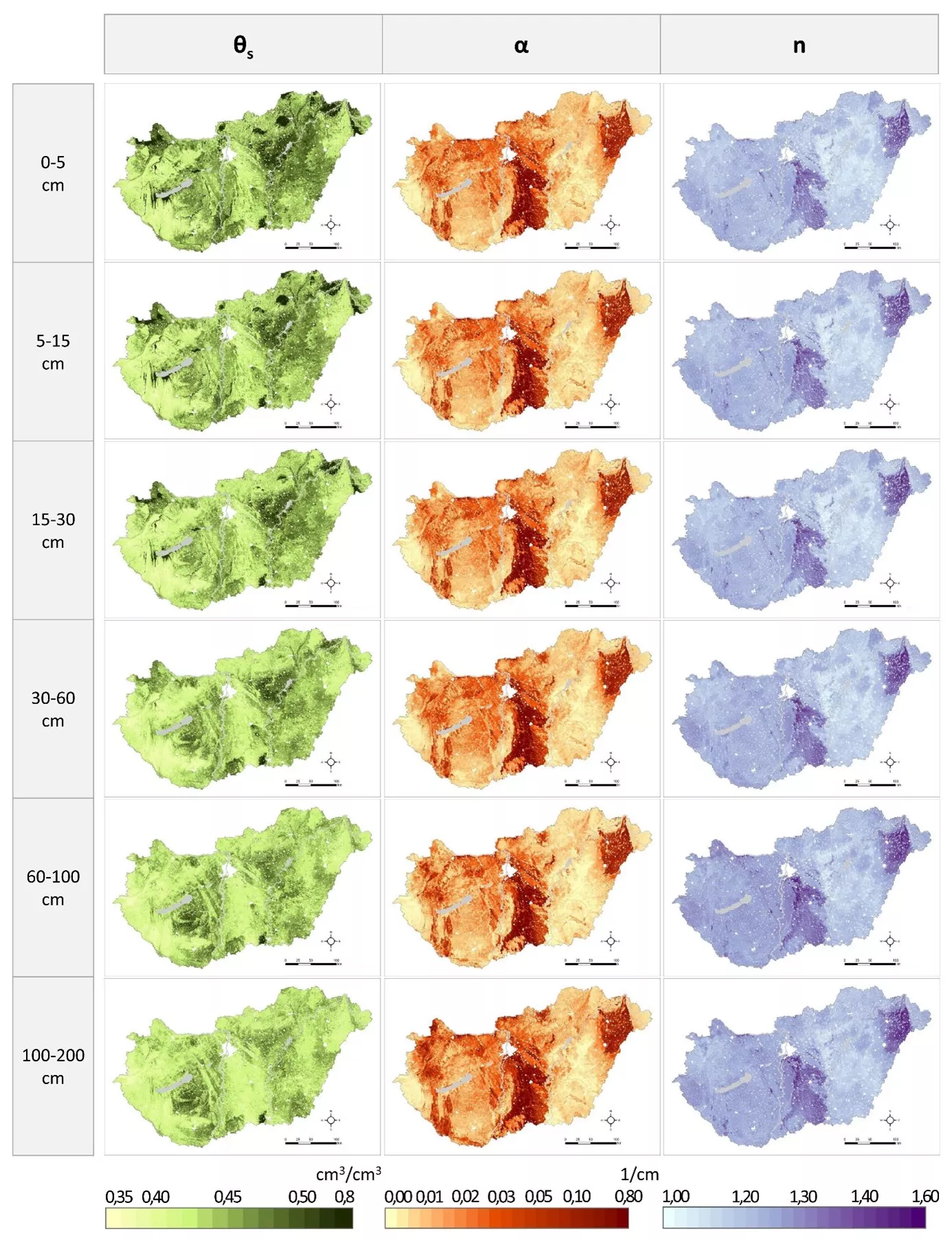
- To spatially apply the resulting models, 100 m resolution information on primary soil properties was obtained from DOSoReMI.hu (Digital Optimized Soil Related Maps and Spatial Information in Hungary).
- Finally, based on a detailed accuracy assessment, the spatial predictions (map products) were complemented with co-layers representing the 5% and 95% quantiles.
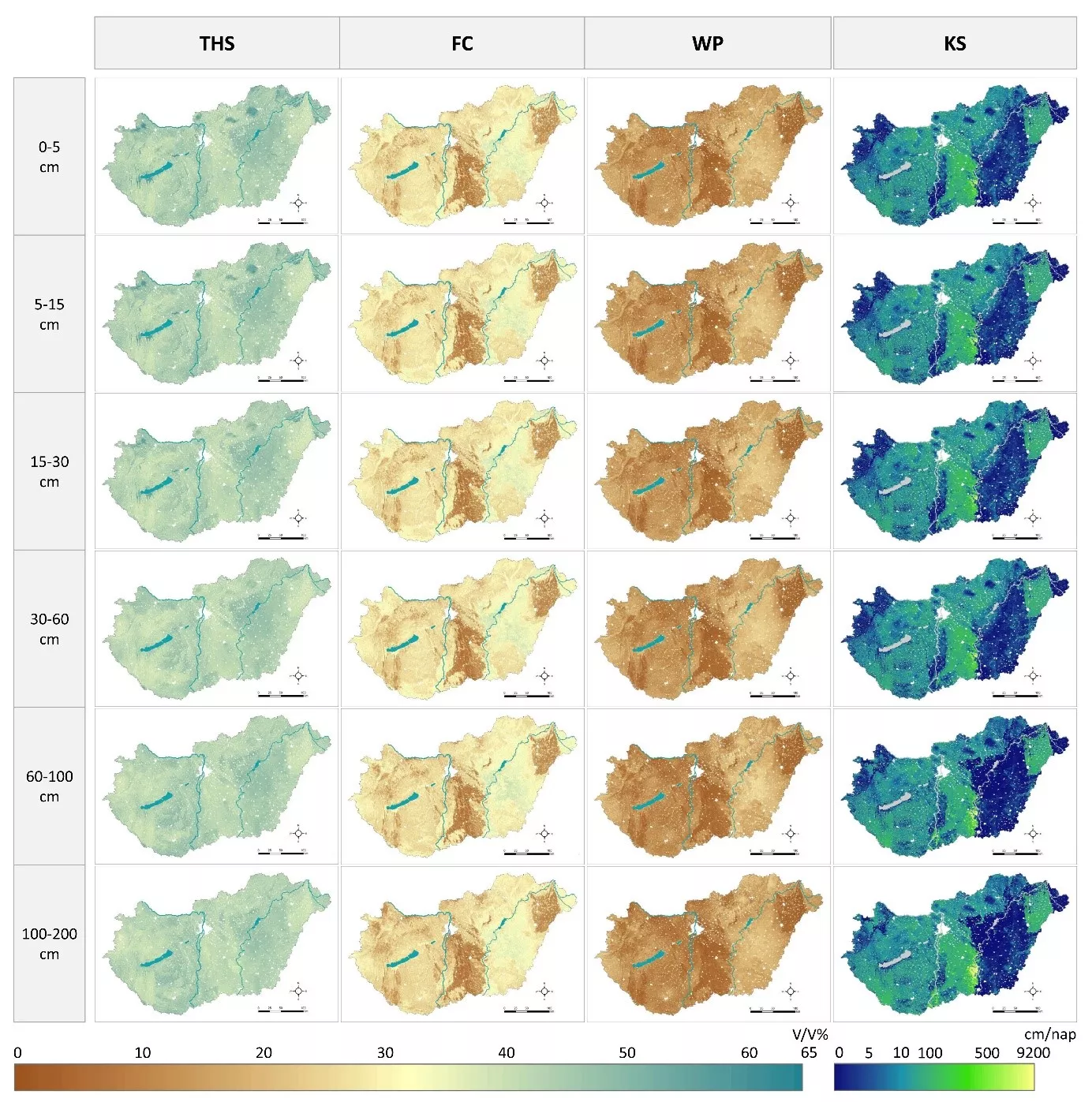
HU-SoilHydroGrids provides nationwide information on the most frequently required soil hydraulic properties (water content at saturation, field capacity and wilting point, saturated hydraulic conductivity and van Genuchten parameters for the description of the moisture retention curve) at a spatial resolution of 100 meters, up to 2 meters soil depth for six GSM standard layers. In comparison to EU-SoilHydroGrids, the description of soil moisture retention curves and hydraulic conductivity has significantly reduced squared error in the case of HU-SoilHydroGrids.
HU-SoilHydroGrids opens up possibilities for countrywide applications and research studies to analyze environmental problems. The further development of this dataset will be directed by its integration into environmental models and their subsequent practical application. The derived 3D soil hydraulic database (ver1.0) is presently available in the frame of National Laboratory for Water Science and Water Safety for project partners in order to test its functional performance in describing hydrological and ecological processes.